


Fishing for history
13th February 2025
West of Port Isaac, the cliffs and coves reveal echoes of the vanished people who once called this stretch of the Cornish coast home
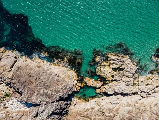
Framed by the twin headlands of Doyden Point and Kellan Head, the narrow channel of Port Quin is a quiet place these days: a cluster of National Trust cottages, a stout harbour wall, a stone slipway. But two centuries ago, it would have been a hive of activity.

“On the cliff, a huer, or watchman, scans the horizon, looking for the shadow of the next shoal”
Imagine, the smell of fish and tobacco smoke, a boat hauled up on the slip. Up the lane, men are scooping salt into cellars to preserve the morning catch. Others work on seine nets, patching the mesh in the sun. There’s banter, laughter, salty cursing. On the cliff, a huer, or watchman, scans the horizon, looking for the shadow of the next shoal. When he sees it, he shouts ‘Hevva!’ and the men drop their tasks, clamber into boats and head out to sea. They’ll stay out as long as their nets can hold fish.

Beyond the postcards
Sometimes it’s easy to forget places like Port Quin had a past beyond the postcards. Port Isaac local John Watts Trevan makes some fascinating fishing observation in his 1834 memoir. But apart from the old cottages and pilchard drying sheds (colloquially known as ‘palaces’), little remains of the industry now. What happened?
“In the cliffs around Port Quin, mineral streaks the rock like veins.”
According to legend, Port Quin’s fishermen were all drowned by a terrible storm – perhaps as punishment for fishing on the Sabbath – and the village was abandoned. In fact, Port Quin was a casualty of economic decline. In the mid 19th century, dwindling fish stocks – particularly in the key species of pilchard and herring – and the slow collapse of Cornish mining forced thousands of families to emigrate – mostly to South America, Australia and Canada. The people of Port Quin were probably among them.

Signs of times past
While the industry is gone, the coast path from Port Quin looks much the same as when the pilchard fishermen and the miners still worked here. Two shafts at Gilson’s Cove Mine, on the coast path from Doyden Point, can still be seen, marked by rings of slate stones. Lead, tin, silver, zinc and antimony – a whitish metal used to make pewter, paint and make-up – were the principal ores mined here. In the cliffs around Port Quin, mineral streaks the rock like veins.
“From Trevan Point, the path descends to Epphaven Cove, a rugged little inlet that’s good for rock-pooling, which also has a small waterfall and natural plunge pool for cooling off on a hot day.”
Near Gilson’s Cove Mine stands another oddity: Doyden Castle, a mock-Gothic folly, built around 1830 by a Wadebridge merchant called Samuel Simmons, who’s said to have used it as a private pleasure den for partying, drinking and gambling.

From Doyden, the coast path climbs up and over Trevan Point – a natural watchtower at 213ft above sea-level, serving-up a fine panorama stretching west to the craggy headland of The Rumps and the offshore island of The Mouls.
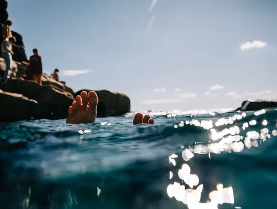
From Trevan Point, the path descends to Epphaven Cove, a rugged little inlet that’s good for rock-pooling, which also has a small waterfall and natural plunge pool for cooling off on a hot day. The slate here has sometimes yielded fossils, too, so keep your eyes peeled.

Hidden hideaways
Around the headland to the west lies Lundy Bay, another rocky beach where you can climb down via wooden steps. The cliffs and fields around here are managed by the National Trust for wildlife, cutting back the hawthorn hedges and preserving grassland habitat; it’s a good place for spotting wildflowers, butterflies and birds of prey.
Just above the western edge of the beach is Lundy Hole, where you can peer down and watch the breakers booming under the rock arch: this sea cave is said to have been the hiding place for St Minver fleeing the devil.
A little further west is a cleft in the cliff known as Markham’s Quay. Here, sand and gravel were hauled up from the beach by horse-drawn carts. It’s also a fabled smugglers’ haunt, where contraband was landed under cover of darkness. Was Markham a smuggler, or one of the Preventive men who patrolled the coast and tried to catch them? No one remembers now.
“Nowadays, the headland is a cracking spot for a picnic. In summer, the rocky island off the point, The Mouls, hosts squawking colonies of gannets, kittiwakes, fulmars and sometimes puffins (lundy derives from the old Norse word for puffin).”

Pathways to the past
From here, you can choose either to turn back to Port Quin or hike out another couple of miles past Carnwether Point to The Rumps, which snakes seawards like a sleeping dragon. During the Iron Age, one of north Cornwall’s most important promontory forts stood here. You can make out the outline of the ditches and embankments that protected the fort from assault. Archaeological excavations have turned up artefacts suggesting the people here traded with the Mediterranean.
Nowadays, the headland is a cracking spot for a picnic. In summer, the rocky island off the point, The Mouls, hosts squawking colonies of gannets, kittiwakes, fulmars and sometimes puffins (lundy derives from the old Norse word for puffin). It’s also an infamous shipwreck spot: in 1995, when the Maria Assumpta, the world’s largest square-rigged sailing ship, went down while trying to make Padstow harbour, with the loss of three crew.

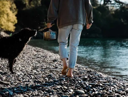
All told, the walk from Port Quin to the Rumps is a 6.5 mile return journey – a three-hour hike, there and back. To ease tired limbs, you can book a shipping container sauna courtesy of Cornish Coast Adventures, overlooking the beach where the fishermen once worked. Times have certainly changed at Port Quin.
Discover stays along Cornwall’s storied north coast this Secret Season.
